
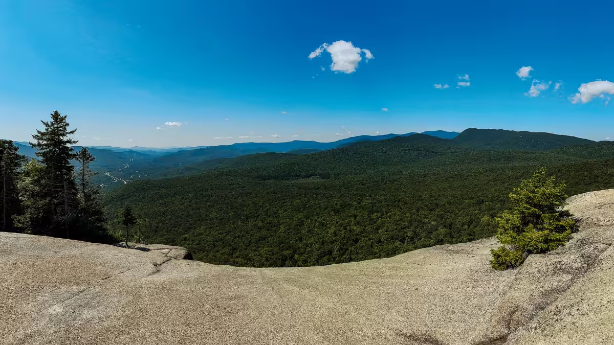
Mount Pemigewasset is only a little over three miles round trip, but don’t mistake that for an easy trail run.
I ran the 3.11-mile out-and-back from the Flume Gorge parking area with my fiancee, Kaitlyn, gaining 1,234 feet in just over three miles. We power-hiked most of the climb, then ran as much as we could coming back down, while doing plenty of braking to avoid eating it on the rocks and roots.
And I loved it.
Mount Pemigewasset was our first trail on our first trip to White Mountain National Forest, so it was also my introduction to just how technical running in the White Mountains can get. The footing constantly demands your attention, the climbing makes sustained running difficult, and the descent never really lets you switch your brain off.
I rated Mount Pemigewasset a 7/10 overall. If you enjoy technical trails and a lot of vertical gain packed into a short route, there’s plenty to like here. If you want three smooth, runnable miles, this is not that trail. Here’s the breakdown.
Mount Pemigewasset at a Glance
- Route type
- Out-and-back
- Start → finish
- Flume Gorge parking area → summit → same trailhead
- Highest point
- Mount Pemigewasset · 2,557 ft
- Trails
- Mount Pemigewasset Trail → Indian Head Trail near the summit
- Terrain
- Dirt, roots, rocks and occasional mud
- Exposure
- Mostly wooded · exposed rock ledge at the summit
- Navigation
- Easy · blue blazes and good signage
- Difficulty
- Hard
Should you run Mount Pemigewasset?
Yes, if technical trail running is your thing.
Mount Pemigewasset crams more than 1,200 feet of climbing into a 3.11-mile route, with enough rocks, roots, and steep terrain that we power-hiked the vast majority of the ascent. Even coming back down, I couldn’t completely open up because the footing constantly made me think about where my next step was going.
But, for me, that’s part of what makes the trail fun. Technical trails put me into this weird flow state where I’m not thinking about pace, distance, or anything else. I’m just trying to put my foot in the right place without destroying an ankle. And Mount Pemigewasset gave me plenty of that. But I also wouldn’t pretend that makes it a highly runnable trail.
Run the Mount Pemigewasset Trail if you:
- Enjoy technical trails with rocks, roots, and constant footwork
- Want a lot of vertical gain without committing to a high-mileage day
- Don’t mind power-hiking most of the climb
- Want a short route with a legit summit payoff
Skip the Mount Pemigewasset Trail if you:
- Want something flatter where you can hold a consistent running rhythm
- Are brand new to trail running
- Primarily run roads and want an easy transition to dirt
- Don’t enjoy technical footing or having to slow down on descents
I’d definitely run Mount Pemi again, personally. It probably wouldn’t be the first trail on my list if I had the entire White Mountains to choose from, but if someone suggested Pemi for a morning run, I’d have no problem heading back.
Mount Pemigewasset Trailhead directions
The Mount Pemigewasset Trail starts from the Flume Gorge area in Franconia Notch State Park, just north of Lincoln, New Hampshire.
Current Cannon Mountain guidance directs Mount Pemigewasset visitors to the Flume Gorge parking area at Exit 34A off I-93. From there, the approach follows the bike path before signs direct you toward the Mount Pemigewasset Trail and its blue blazes.
When we ran it, parking was straightforward. We arrived around 10 a.m. on a Sunday in July, found a spot without trouble, and didn’t pay to park.
Finding the actual trail was easier than I expected, too. There are enough signs leading out of the Flume Gorge area that we never had one of those awkward “are we actually on the trail?” moments before the run even started.
The route
I ran Mount Pemigewasset as a simple out-and-back from Flume Gorge:
- Leave the Flume Gorge parking area and follow signs toward the bike path
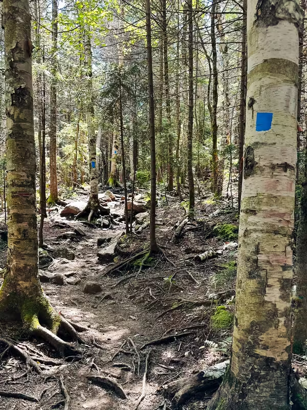
- Pick up the Mount Pemigewasset Trail and follow the blue blazes
- Begin the sustained climb through the forest
- Continue toward the Indian Head Trail junction near the summit
- Follow the final approach to the open summit ledges
- Retrace the same route back to Flume Gorge
My GPS recorded 3.11 miles and 1,234 feet of elevation gain. Current official descriptions put the standard route at just over three miles with roughly 1,250 feet of climbing, so my GPS numbers line up closely with the published route.
The climb up Mount Pemigewasset
The first thing that got my attention was how quickly the trail introduced me to White Mountains terrain.
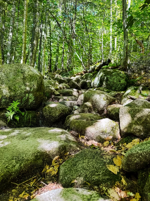
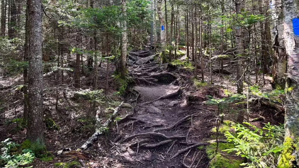
This was the first route Kaitlyn and I ran on our way into the area, and I had never really run trails this technical before. Suddenly I was dealing with roots, rocks, uneven footing, and a trail steep enough that trying to force a running pace would have been pretty pointless. So we mostly stopped trying.
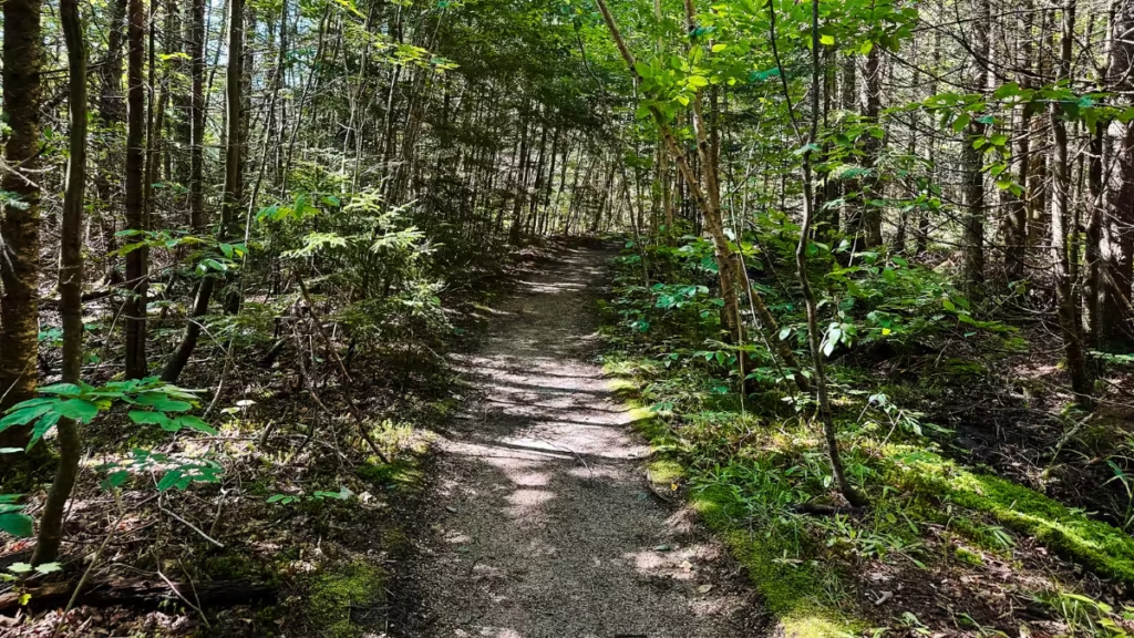
There were a few flatter sections where we could run, especially early, but the majority of the climb was a power hike. And the grade was only half the problem. Even when the terrain eased slightly, all of the rocks and roots made it difficult to get back into a rhythm. You’re constantly shortening a step, moving around something, stepping onto a rock, or thinking about where your foot is going next.
- Liked: The technical terrain forced me to stay completely focused, which is something I really enjoy.
- Surprised by: Just how much careful foot placement White Mountains trails require.
- Watch for: Damp roots, rocks, and muddy spots that can make an already technical trail slower.
The Mount Pemigewasset summit
The summit is where the route earns a lot of its 7/10 rating for me.
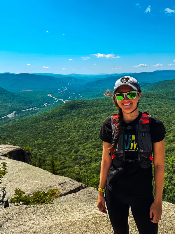
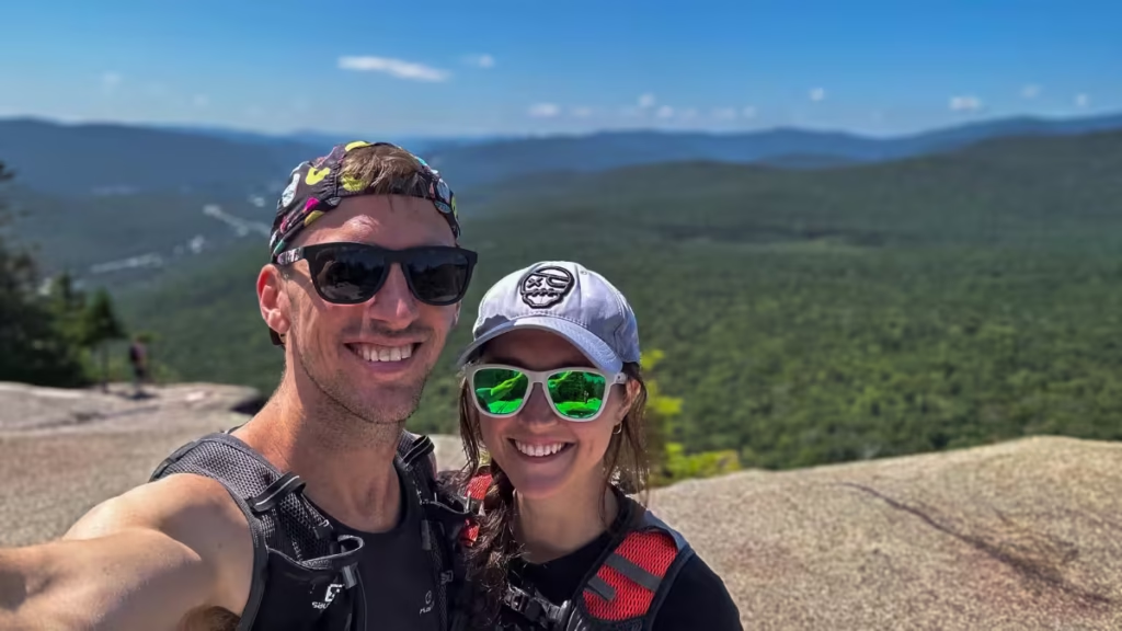
You spend almost the entire climb enclosed in dense forest. Then you come out onto a broad rock slab and suddenly everything opens up. And that reveal is excellent. It’s an unobstructed view across the surrounding mountains and forest, and it was one of my favorite viewpoints from that first White Mountains trip.
We spent roughly 10–15 minutes at the summit before heading back down. There were a couple of groups up there, but nothing close to the crowds I’ve experienced on some of the more popular short White Mountains routes. Also, the summit was noticeably busier than the trail itself, although even that never felt overwhelming.
The one thing worth knowing is the exposure.
You pop out of the forest onto a large rock slab with a sharp drop beyond it. You don’t need to walk anywhere near the edge to enjoy the viewpoint, and I wouldn’t describe the summit as some terrifying scramble. But I’d be lying if I said getting close to the ledge didn’t make me slightly uneasy, and I don’t even have a particular fear of heights. If heights bother you, though, you’ll probably feel it.
- Liked: The sudden transition from dense forest to a completely open mountain view.
- Watch for: The summit ledge if exposure or heights make you uncomfortable.
- Crowds: A few groups when we visited around late morning on a Sunday, but nothing that affected the experience (and I say that as someone who hates crowds).
Running back to Flume Gorge
The descent is where Mount Pemigewasset finally becomes more of a run.
Emphasis on more.
We ran as much of the return trip as we could, and obviously gravity makes the trail much easier to run than it was going up. But the technicality doesn’t disappear just because you turned around. Those same rocks and roots are now coming at you considerably faster.
I spent a lot of the descent braking and controlling my pace rather than opening my stride. There were sections where I found a good rhythm, but this isn’t the kind of downhill where I’d switch my brain off and fly. In fact, I wouldn’t recommend switching your brain off at all or else you’ll find yourself with a face full of mud or rock.
The simplest description of Mount Pemigewasset as a trail run:
Power-hike up. Controlled run down.
If that sounds fun, you’ll probably enjoy it as much as I did. If it sounds frustrating, listen to that instinct and pick one of the others in the area (check below for some of my recommendations).
Mount Pemigewasset photos
Mount Pemigewasset Trail logistics
- Budget more time than the mileage suggests. My 3.11-mile route took 54:53 of moving time and 1:28:52 elapsed after spending time at the summit.
- The descent is more runnable, but still technical. I ran most of what I reasonably could coming down, but the footing required enough braking that it never became a fast downhill.
- Start at Flume Gorge. Current guidance directs Mount Pemigewasset visitors to the Flume Gorge parking area at Exit 34A. Follow the bike path and signs toward the Mount Pemigewasset Trail.
- Navigation is straightforward. The route is marked with blue blazes, and I found the signs easy to follow. I still loaded the route onto my watch beforehand because that’s what I normally do somewhere unfamiliar.
- Conditions matter. We had a clear, warm day with mostly dry-to-damp footing and occasional mud. Even then, rocks and roots demanded attention. I’d be considerably more conservative if everything were wet.
Nearby White Mountains trails
Mount Pemi is a great short option, but it sits in an area where you have several very different trail running experiences close by. Here are a few I’ve run and recommend:
- Franconia Ridge Loop (8 miles)
- Mount Willard Trail (3.1 miles)
- Presidential Traverse (19 miles)
- Mount Moosilauke (7.5 miles)
- Franconia Falls Trail (7.7 miles)
- Artists Bluff Trail (1.3 miles)
- Kearsarge North (6 miles)
Want more options? Browse my Trail Running Route Database to compare more routes by distance, difficulty, location, and rating.

Leave a Reply