
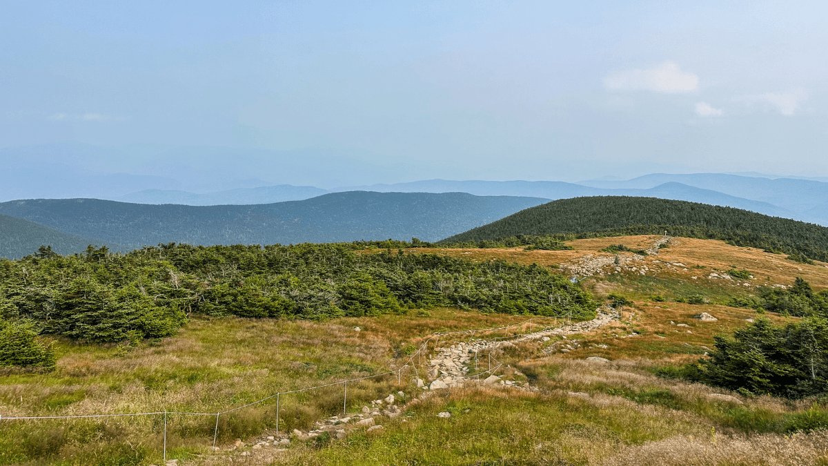
Mount Moosilauke is a 7.7-mile loop in White Mountain National Forest, climbing to one of the best summit approaches I’ve hit in the Whites in about 1.5 to 2.5 hours round trip. I rated it a 7.5/10 overall, with the sustained technical climb and thin parking hold it back a little, but the golden-grass stretch leading into the summit is one of my favorite pieces of trail I’ve run, wildfire smoke or not.
Mount Moosilauke at a Glance
- Route type
- Loop
- Start → finish
- Ravine Lodge Trailhead → same trailhead
- Highest point
- Mount Moosilauke · 4,802 ft
- Terrain
- Roots, rocks, stream crossings and occasional scrambling
- Exposure
- Exposed and windy above treeline
- Water
- Stream crossings on the climb · carry your own supply
- Route
- Gorge Brook → summit → Carriage Road → Snapper Trail
- Main climb
- Sustained 9–10% grade for roughly 3.5 miles
For a complete list of trails, be sure to check out my Trail Running Route Database where I add, review, and recommend every trail I’ve run around the world.
Should you run it?
Treat the climb as a hike with runnable stretches, not a run. The first 3.5 miles hold a sustained 9–10% grade over roots, rocks, and stream crossings, and power hiking is the honest way up for most people. Where it pays off: you break out of the trees onto a rocky path through golden grass that leads all the way to the summit, which is one of the better approaches I’ve run in the Whites.
Run Mount Moosilauke if you:
- Want a technical, root-and-rock climb that keeps you focused the entire time
- Like having the trail mostly to yourself, the crowds here are light
- Are fine hiking the hard sections and running what you can on the way down
Skip Mount Moosilauke if you:
- Want a trail you can hold a running rhythm on start to finish
- Aren’t prepared for a sustained climb at 9-10% grade for 3.5 miles
- Need guaranteed parking, this lot fills fast with limited overflow]
Mount Moosilauke trailhead directions
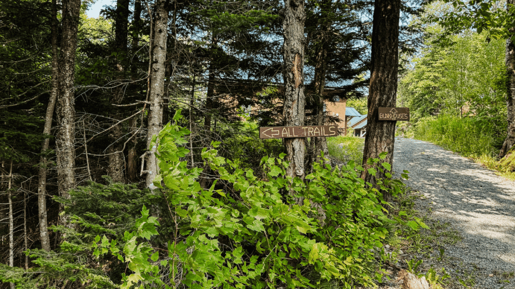
Most runners start at the Ravine Lodge Trailhead, just off NH Route 118 about 7 miles south of Warren. There’s a dirt lot, but it fills fast, so get there early, especially during busier seasons. Once it’s full, parking shifts to the side of the access road — which is what we had to do on our visit. From the lot, follow the road as it splits toward the lodge, then descends to the trailhead itself.
Cell service is spotty out here, so download your route offline before you go.
Plan your next runcation without overthinking it
A free, runner-tested weekend kit with:
- A simple trip-planning framework
- A packing checklist that actually works
- A quick decision guide for short travel runs
The route
There are multiple ways to the top of Moosilauke. Gorge Brook is the most popular approach to the summit, and once you’re up there you’ve got a few options for the way back down.
I climbed via Gorge Brook and descended the South Peak Loop, so that’s the route below. If you’re set on a different combination, the climb and summit sections will still apply, but budget your own time for whichever descent you pick.
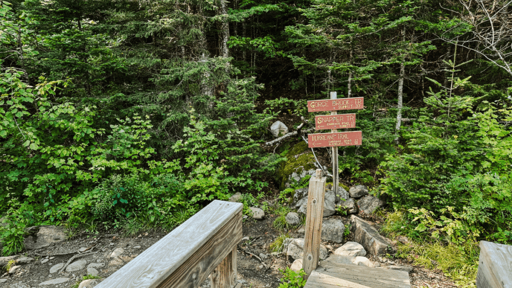
- Sign in at the trail register and cross the small bridge at the Gorge Brook trailhead
- Climb steadily through the forest at a 9-10% grade for about 3.5 miles
- Break above treeline onto the golden-grass summit approach
- Reach the summit
- Descend via the historic Carriage Road
- Follow the Snapper Trail back to the trailhead
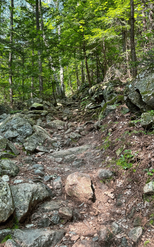
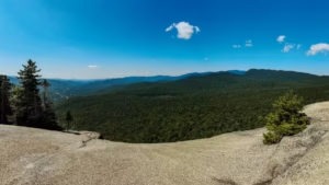
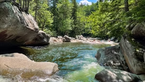
The climb: The first quarter-mile is gentle, then the grade kicks in fast and holds for 3.5 miles. There are flatter stretches where you can open it up, but the roots, rocks, and stream crossings slow even fast runners — I switched to power hiking for most of it and found I held a similar pace anyway. As the trees start thinning near the top, the views should open up, though a heavy wildfire smoke haze wiped mine out on the day I ran it.
- Liked: the mix of running, power hiking, and the occasional scramble kept the climb interesting instead of just grinding
- Watch for: the grade eats time, budget some hiking pace here, not running pace
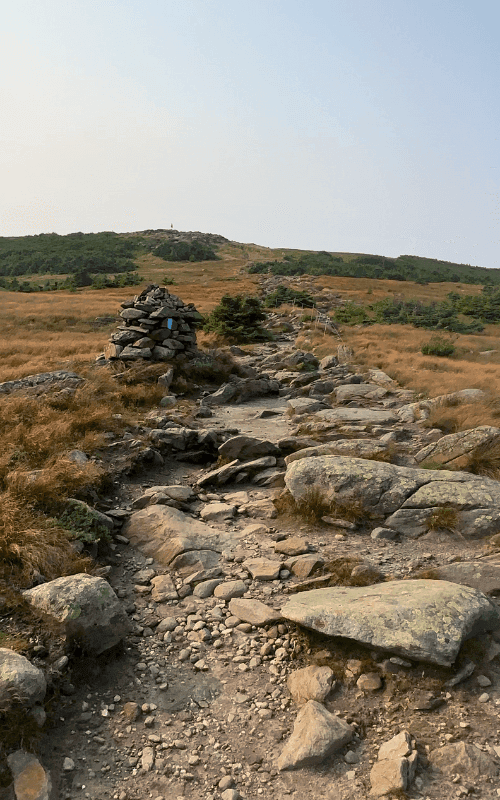
The summit approach and top: Once you clear the treeline, the trail turns into a rocky path winding through high golden grass on both sides — I hadn’t seen this stretch in any trip photos beforehand, and it was one of my favorite pieces of trail I’ve run in the Whites. The wind picks up fast once you’re exposed at the top, even if the climb felt calm the whole way up. A storm was pushing in on my run, which cut my time at the summit short.
- Liked: the golden-grass approach to the summit is worth slowing down for, even if you’re tight on time
- Watch for: wind and weather shift fast up top, keep an eye on the horizon and don’t linger if something that’s building in
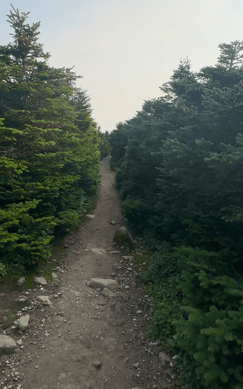
The descent: You start down on the Carriage Road, which really was used by carriages back in the day. It’s wide, historic, and a nice change of pace after the technical climb, though I was running through puddles from recent rain. From there it’s the Snapper Trail back to the trailhead, running under roughly 7-foot-high trees the whole way.
- Liked: the Carriage Road is wide and runnable, a good reset after the climb
- Watch for: can get muddy and puddle after rain
Photos from the Mount Moosilauke Trail

Mount Moosilauke Trail logistics
- Budget 1.5 to 2.5 hours round trip, with most of the climb at hiking pace.
- Download your route offline before you go. Cell service is spotty at the trailhead and stays spotty on trail.
- Go early, especially in fall. The lot at Ravine Lodge fills fast, and overflow parking along the access road is limited.
- Layer for wind at the summit, even if the climb up feels calm, it hits hard and fast once you’re exposed.
- Check the forecast right up until you go, and again once you’re on trail. Conditions above treeline can shift quickly.
- Bring more water than you think. Base layer, rain jacket, and bug spray are worth packing regardless of season.
Great Trail Options Nearby
There are still so many trails in White Mountain National Forest that I have to run/write about, but here are a few I’ve covered so far that I highly recommend:
- Franconia Ridge Loop (8 miles)
- Mount Willard Trail (3 miles)
- Presidential Traverse (19 miles)
- Artists Bluff Trail (1.3 miles)
- Franconia Falls Trail (7.7 miles)
- Mount Pemigewasset (3.1 miles)
- Kearsarge North (6 miles)

Leave a Reply