
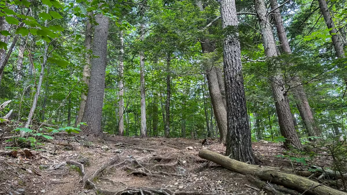
Kearsarge North is a 5.96-mile out-and-back near North Conway that packs more than 2,500 feet of climbing into a pretty short distance. And if you’re coming here to trail run it, I’d go in expecting more of a hike-run hybrid than six miles of continuous running.
The grade gets steep enough that running stops making much sense, and the usual White Mountains combination of roots, rocks, and slabs makes maintaining any sort of rhythm even harder.
But coming back down is a different story.
Once I turned around at the summit, I could run a decent amount of the descent, picking lines through the rocks and roots and getting into that technical-trail flow state I love. Add the summit fire tower and views, and I came away rating Kearsarge North a 6.5/10 overall. This doesn’t mean I disliked it. It means Kearsarge North is a specific type of trail: great if you like steep climbing and technical descending, less compelling if you want sustained running.
One naming distinction before we go any farther: Kearsarge North is not Mount Kearsarge near Warner and Wilmot, New Hampshire. This review covers the Kearsarge North Trail from Hurricane Mountain Road in White Mountain National Forest.
Kearsarge North Trail at a Glance
- Route type
- Out-and-back
- Start → finish
- Kearsarge North Trailhead → same trailhead
- Highest point
- Kearsarge North · 3,268 ft
- Terrain
- Dirt, roots, rocks, rock slabs and occasional mud
- Exposure
- Mostly wooded with increasingly open ledges near the summit
- Water
- No potable water at the trailhead · carry your own supply
- Navigation
- Easy · follow the Kearsarge North Trail
- Difficulty
- Moderate
Should you run the Kearsarge North Trail?
Yes, especially if you consider power hiking part of trail running rather than something you’re trying to avoid.
Kearsarge North works best as a hard climbing workout followed by a technical downhill run. The ascent gains about 2,500 feet in roughly three miles. There are a few sections where the grade and footing ease enough to run, especially lower on the mountain, but I wouldn’t come here expecting to run continuously to the summit.
The descent is where the route got much more fun for me. I could run a decent amount of the trail back down, but it requires attention. Roots, rocks, slabs, and the steep grade mean you’re constantly picking a line, adjusting your stride, and occasionally hitting the brakes. That’s exactly the kind of trail running I enjoy.
Run the Kearsarge North Trail if you:
- Enjoy technical trails and constantly picking your line
- Want a hard workout with a lot of vertical gain in six miles
- Don’t mind power-hiking most of the climb
- Want a summit payoff and fire-tower views in the middle of your run
Skip the Kearsarge North Trail if you:
- Don’t enjoy roots, rocks, slabs, or technical footing
- Want a trail you can continuously run from start to finish
- Don’t want a lot of vertical gain
- Are looking for a shorter, easier outing
Kearsarge North Trailhead directions
The Kearsarge North Trail starts from a small trailhead on Hurricane Mountain Road in Intervale, just outside North Conway.
From Route 16, turn onto Hurricane Mountain Road and follow it to the small parking area. The trail leaves directly from the lot, so finding the start is about as simple as it gets. The Forest Service identifies this as the Kearsarge North Trailhead and places it about 1.5 miles up Hurricane Mountain Road from Route 16.
The parking lot is the bigger issue.
When Kaitlyn and I arrived around 2:45 p.m. on a Wednesday in July, only a couple of cars were there, so we had no problem getting a space. But this is a tiny lot. Its capacity is only roughly 8–10 vehicles and it can fill quickly on good-weather weekends. I don’t remember seeing bathrooms or water there, and current Forest Service information confirms there are neither restrooms nor potable water at the trailhead.
The route
My route was simple: Kearsarge North Trail all the way up, then the same trail all the way back.
- Leave the Hurricane Mountain Road trailhead on Kearsarge North Trail.
- Follow the initially gentler forest trail as the climbing gradually increases.
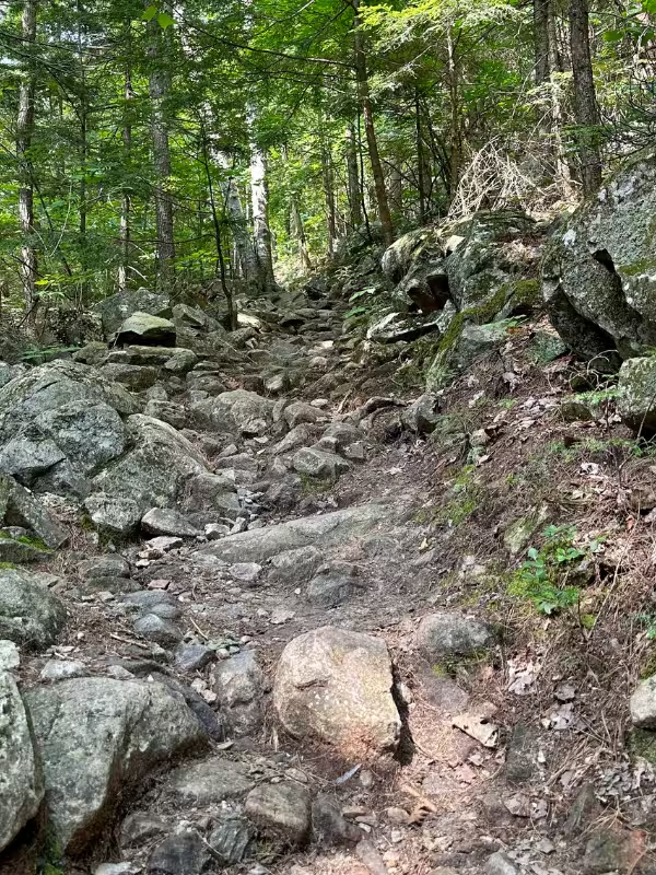
- Continue up increasingly steep, rooty, and rocky terrain.
- Follow the blazes and painted arrows across the upper rock slabs.
- Reach the summit ledges and Kearsarge North fire tower.
- Descend the same Kearsarge North Trail back to Hurricane Mountain Road.
The lower trail
The beginning gives you some of the best uphill running of the route.
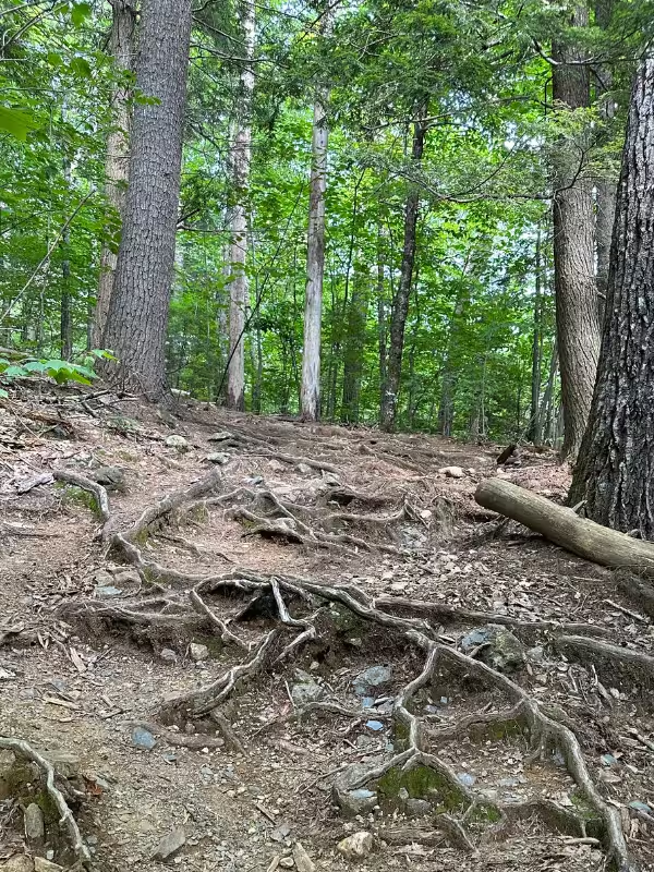
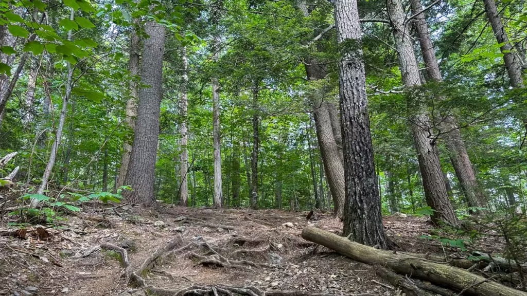
The trail starts through the forest on a mixture of dirt, roots, and rocks. It isn’t flat, but there were small stretches where Kaitlyn and I could actually run before the mountain started taking that option away from us. As the climb continued, the grade gradually became the bigger problem.
It wasn’t just that Kearsarge North was steep. The combination of climbing and having to constantly choose where to put my feet made trying to keep a run going felt increasingly inefficient. That’s when I switched over to power hiking.
- Liked: There’s enough variation in the footing to keep the climb interesting rather than feeling like one long grind
- Expect: A few runnable stretches, but don’t get emotionally attached to running the entire ascent
- Watch for: Roots, rocks, and occasional muddy patches
The middle climb
This is where Kearsarge North really turns into a power-hiking workout.
The grade gets steeper while the trail becomes increasingly rocky and technical. Neither element by itself felt extreme to me. It was the combination that killed the runnability. I could occasionally start running again when the trail gave me a better stretch, but most of the ascent was better handled by hiking hard and keeping the effort consistent.
That isn’t necessarily a negative.
I like climbing, and I like using power hiking as part of a trail-running workout. Kearsarge North gave my legs exactly that kind of effort. If your idea of a good mountain run includes hiking the steep stuff and making the time back on the descent, this section works.
- Liked: The climb felt like a legitimate workout instead of just transportation to the summit
- Could be a negative: If you measure a good trail by how many miles you can continuously run, this climb will frustrate you
- Watch for: The grade and technical footing working together to slow you down
The upper slabs and summit
As I got closer to the top, the forest started thinning and the views began opening up.
The trail also transitions onto more exposed rock and slab, with painted markings helping guide the way. Navigation never caused us any problems. The route was well-marked throughout, including arrows across the rock where a dirt tread was less obvious.
Eventually, the fire tower comes into view on the rocky summit. This was the payoff.
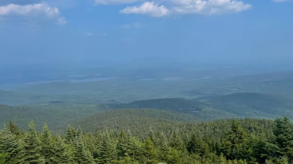
Unfortunately, wildfire smoke was blowing into New Hampshire that day, so the visibility wasn’t nearly as good as it could have been. We could still see the surrounding mountains, and the view from the fire tower was worth the climb, but I’d love to come back on a crystal-clear day and see what we missed.
We hung around the summit for roughly 30–45 minutes, taking photos and video and enjoying having the place mostly to ourselves. Only one other couple was there when we arrived, and they left shortly afterward.
- Liked: The fire tower and summit give the climb an actual destination and payoff
- Frustrated by: Wildfire smoke limited what should have been a much better view
- Watch for: Conditions on the exposed rock will matter much more when it’s wet
The descent
This was my favorite part of Kearsarge North.
What had been mostly a power hike on the way up became substantially more runnable heading back down. I still couldn’t completely let go. The same roots, rocks, slabs, and steep grade that slowed the ascent required plenty of braking on the descent, and there were sections where I had to back off and pick my way through.
But when the trail opened up enough, it was ridiculously fun. This is the kind of technical downhill where my brain switches into that flow state and basically everything becomes find the next line, hit it, react, repeat. And my splits show the difference pretty clearly. After climbing almost 1,000 feet during both miles two and three, my fifth mile dropped more than 1,000 feet at 11:58/mile.
That doesn’t make Kearsarge North a highly runnable trail overall. I still gave it only a 6/10 for runnability because so much of the ascent is better power-hiked. But if you enjoy technical descending, there’s plenty here to have fun with.
- Liked: Picking lines and reacting to the terrain made this the best running of the day
- Expect: Much more running than on the ascent
- Watch for: It’s easy to carry too much speed into roots, rocks, and steeper slab sections
Kearsarge North Trail photos


Kearsarge North Trail logistics
- Parking: The Hurricane Mountain Road trailhead is small. I had no trouble parking on a Wednesday afternoon, but the capacity is only around 8–10 vehicles.
- Bathrooms and water: There are no restrooms and no potable water at the trailhead.
- Terrain: Expect the standard White Mountains mix of roots, rocks, dirt, and slabs. The footing and grade get progressively harder as you climb.
- Navigation: I found it straightforward. The trail was well-marked, including arrows across the upper rock slabs. I still loaded the GPX onto my watch, which I do for basically every unfamiliar trail.
More White Mountain trail runs
If you’re putting together a longer New Hampshire running trip, these are some of my other firsthand trail reviews:
- Franconia Ridge Loop (8 miles)
- Mount Willard Trail (3 miles)
- Presidential Traverse (19 miles)
- Artists Bluff Trail (1.3 miles)
- Franconia Falls Trail (7.7 miles)
- Mount Pemigewasset (3.1 miles)
For a bigger picture, my White Mountain National Forest Trail Running Guide compares the routes I’ve run throughout the area, and the Trail Running Route Database has every route I’ve reviewed so far.

Leave a Reply