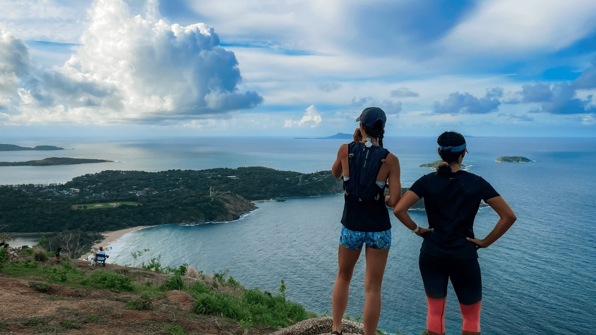
When people think of Thailand, they definitely don’t think of Phuket hiking or trail running.
The gorgeous beaches of Phuket, culture, delicious food…more beaches? That’s what most people think of.
But there are actually tons of hiking trails to explore, spread across the island. Ad I had the chance to explore many of the trails while I ran all over Phuket for two years. So, I’m here to help you find the best hiking in Phuket. Or, if you’re a trail runner, you can use the same trails at a faster pace.
These 11 trails are spread out across the island (and even just off the island). These will help you plan the perfect runcation to get beautiful Phuket viewpoints, the best waterfalls on the island, and everything in between so you
So, put on your best pair of travel running shoes, and let’s get to ’em.
Note: Land development happens frequently in Phuket. So these trails can change at any moment. Along with heavy rain and landslides. So be prepared to adjust any hikes in Phuket.
11 Best Trail Running Trails in Phuket
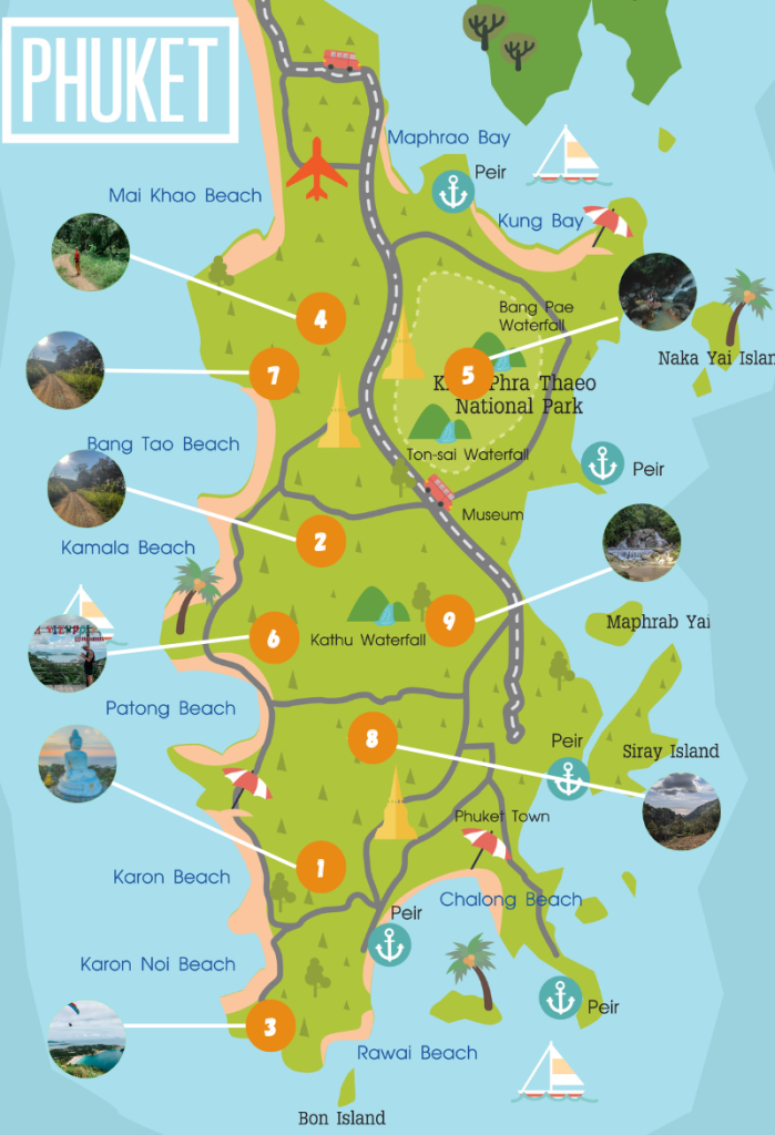
This map only has nine running trails in Phuket listed. That’s because I wanted to highlight the main trails on the island. The last two can be found north of the island.
1. Karon-Big Buddha
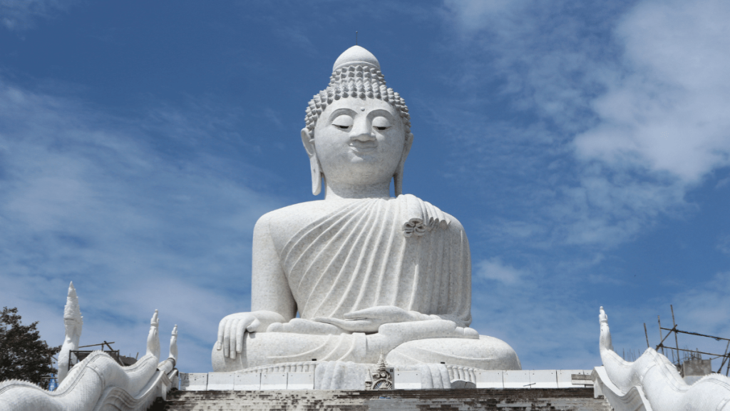
Big Buddha is the largest (and most important) attraction on the island.
And there’s no better way to experience it than to really earn it through a dense jungle run. Most people start at Kata Beach to Big Buddha. But I think the Karon route is more fun, personally. It’s also the first Phuket trail I ever hiked (and what convinced me to stay for a while).
This run will have a TON of vert. In fact, the first three miles has around 1000 feet of elevation gain. But it’s an awesome run.
You start out on the road before cutting off into the dense jungle leaves and trees. If you’re unsure of where to start, it’s always good to know how to find running routes anywhere you travel. But, on this route, there’s a chance to see monkeys, snakes, and elephants along the way. about two and a half miles in you see Big Buddha’s white marble for the first time up close.
If you plan on visiting Big Buddha and not just stop by, be sure to wear appropriate clothing. There’s no entrance fee, so don’t worry about carrying money other than for snacks/drinks. Cover your shoulders and skin above the knees. You’ll see tons of people taking day trips here.
Wat Chalong isn’t far away (once you’re at the bottom of the hill), so you can pair this if you’re looking to add some distance.
Bring plenty of water with you. It gets extremely hot in Phuket, and the jungle foliage traps the heat in.
You often won’t even notice how much you’re sweating.
There also may be dogs along the route. Usually picking up a stick or rock is enough to scare them off.
Then it’s back down the hill via the trail same trail you started.
Karon-Big Buddha Trail details
- Distance: 5 miles (8 kilometers)
- Elevation gain: 1300 feet (400m)
- Route type: Loop
- Time: Around 2-3 hours
How to get to the Karon-Big Buddha trail
Karon Beach is on the western part of the island. Follow Patak Road until you find Soi 14. This is where it starts.
You can find the entire loop below on AllTrails:
Personal review of Karon-Big Buddha trail
I loved this trail but only did it a few times because I lived a bit north of Karon. If you want a great workout with a rewarding view at the end, then this is the trail to visit.
If you’re looking for something a bit more relaxing, then I’d check another trail on this list.
2. Manik Mining Trail
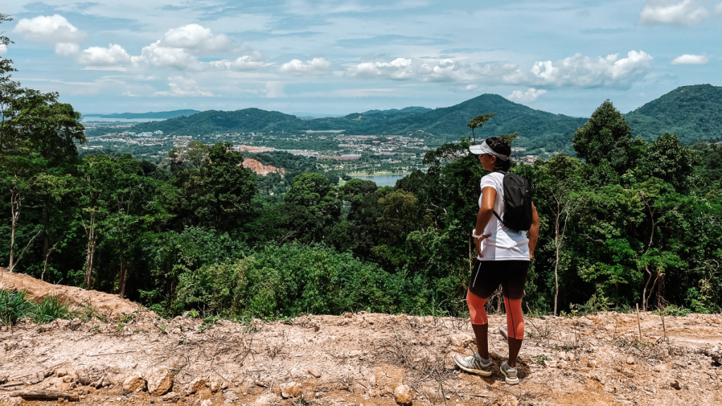
This was my personal go-to for everyday training runs.
It has a great balance of being challenging while also fun. Plus, I think the top is one of the best viewpoints in Phuket. This is also a trail you won’t find on ANY other list.
The Manik Mining Trail isn’t super popular, which is one of its best qualities.
It starts at Manik Dam, then follows a road until it leads to an all-dirt trail. About a mile in, a gradual climb starts and (mostly) goes to the top. There are some flat areas mixed in, but you’ll be climbing most of the way.
I think it’s a great mix, though. You can run it if you’re looking for a difficult workout. It’s also great for hill intervals. Or you can hike a lot of it if it’s an easy day.
It’s like a choose-your-adventure type of trail.
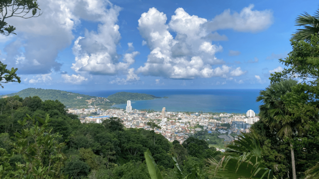
The top has views out over Kathu to the south and also out over the Thalang area to the north. Visit at sunrise for the perfect, non-touristy thing to do in Phuket.
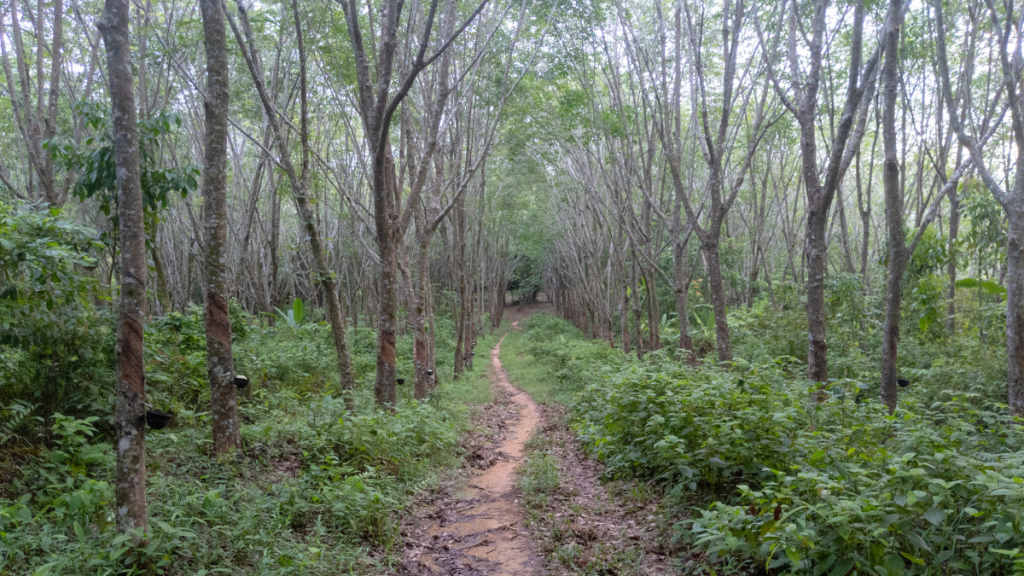
Continue along the trail to continue into the rubber trees and extend the run into the Patong/Kathu hills.
Manik Mining Trail details
- Distance: 7 miles (12 kilometers)
- Elevation gain: 1500 feet (480m)
- Route type: Out-and-back
- Time: Around 3 hours
How to get to the Manik Mining Trail
Manik Dam is in the island’s northern part near the Cherng Talay/Bang Tao area. On the eastern side of the dam is a dirt road that splits off from the main road. It starts here.
You can see the full details on AllTrails below:
Personal review of the Manik mining trail
As I mentioned, this was a daily trail for me when I lived in Phuket. So much so that the local rubber tree farmers came to recognize me as the crazy farang that runs all the time.
This trail is great for all levels of runners, so I recommend it no matter the type of run you want.
The main downside is it’s an area of the island that most people don’t visit as frequently.
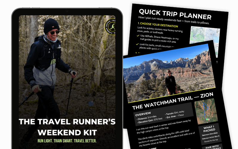
Plan your next runcation without overthinking it
A free, runner-tested weekend kit with:
- A simple trip-planning framework
- A packing checklist that actually works
- A quick decision guide for short travel runs
3. Black Rock
While Manik Mining Trail may be my favorite, I think it’s hard to argue the Black Rock trail isn’t the most scenic.
I mean, look at that viewpoint.
The trail starts near Nai Harn Beach before climbing into some of the good ol’ Phuket jungle. There are views out over the beach along the way, so you won’t be entirely surrounded by dense jungle the entire time. But, you’ll definitely be working.
It’s uphill almost the entire way.
But once you get to the top, that burn in your legs will give way. Nai Harn Beach (one of Phuket’s best beaches) sits below, with Windmill Viewpoint in the distance. It’s a killer view.
Afterward, you’ll fly downhill toward the ocean on some fun (and sometimes scary) trails until you reach ocean level and start wrapping back toward Nai Harn Beach.
Overall, you’ll get some real good running in if you enjoy uphill running and running downhill.
Black Rock trail details
- Distance: 5 miles (7.8 kilometers)
- Elevation gain: 1400 feet (420m)
- Route type: Loop
- Time: Around 2-3 hours
How to get to the Black Rock trail
Head to Nai Harn Beach and follow the road on the left side of Nai Harn Lake.
When the road meets with another road that cuts right, you’ll go left up a path that begins to rise and proceeds past some rubber tree farms.
You can find the trail on AllTrails below:
Personal review of the Black Rock trail
I only ran this route a couple times, but I’m so disappointed I didn’t more often.
It was a far drive for me (probably around 40 minutes to an hour depending on traffic), and I didn’t venture down to the south of the island often. But this trail is absolutely worth running (even with the drive) if you’re willing to hit some of the best trails on the island. The climbs, the views, and the descents — it’s a trail runner’s dream.
4. Nai Yang Hills
I didn’t discover this trail running area until a few months before I left.
But it has some of the best running trails in Phuket. And I wish I would’ve discovered them sooner and enjoyed them more. This area isn’t visited by many tourists (if any). So you’ll mostly see rubber tree farmers if you see anyone at all. But the area has quite a few trails that all mix and cross so you can get a short or long run in.
Plus, it has a mix of elevation and flat areas. And it has wide, dirt trails with occasional steep and narrow ones. So it’s perfect for a varied trail run.
From certain points on the run, you can see Sirinat National Park. The national park is located on the northwestern part of the island, near the airport.
Nai Yang Hills details
- Distance: 4 miles (7 kilometers)
- Elevation gain: 870 feet (265m)
- Route type: Loop
- Time: Around 2-2.5 hours
How to get to the Nai Yang Hills area
The easiest way to reach the Nai Yang Hills is following route 402 up the middle of Phuket. Then, you can turn off to 4031 or the following left turn to go to the start.
You can find the whole loop on AllTrails here:
Personal review of Nai Yang Hills
If you want almost complete solitude, this is the area to visit. Tourists stay along the Phuket coast almost exclusively. So this inner stretch of forest is the perfect spot to escape.
You’ll likely see some wildlife along the way. But it’s great running overall, so enjoy!
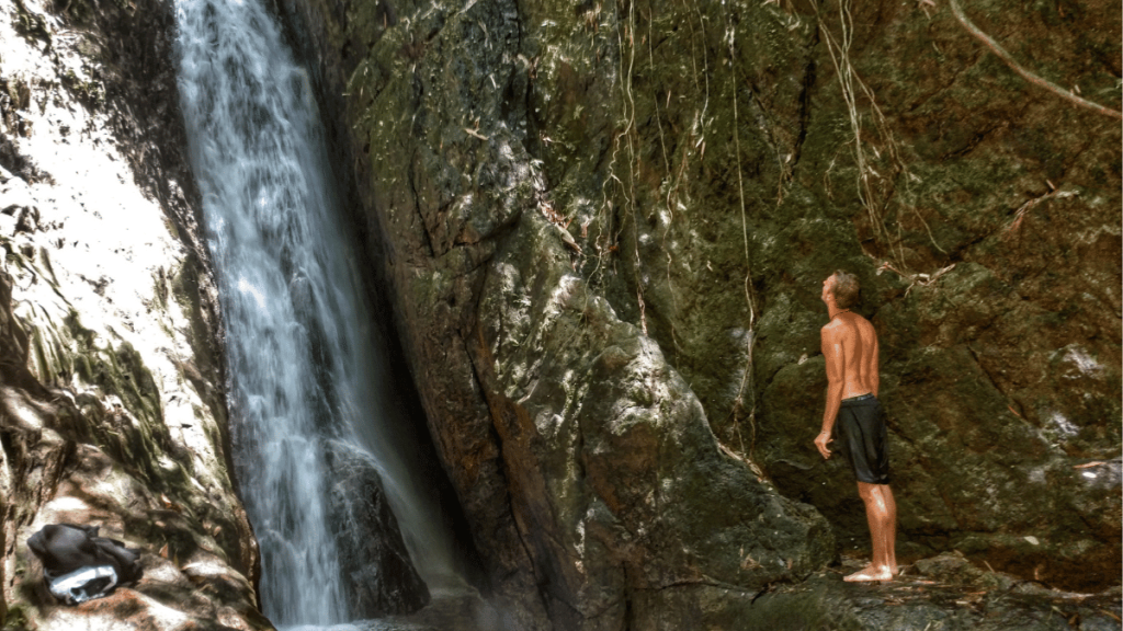
5. Bang Pae to Tonsai Waterfall
Most of these trails have been for mid-long runs.
But if you want a shorter run, then the Bang Pae to Ton Sai Waterfall trail is a great choice. Plus, you have the chance of seeing monkeys! (Just be careful, they can get aggressive.)
This is a Khao Phra Thaeo National Park trail, and it connects two of the island’s most beautiful waterfalls — Bang Pae and Tonsai.
Depending on the season, this trail may be tougher to do. Rainy season can often wash out the trail a decent amount and make it almost impossible to run. But, if the conditions are right, this is an excellent trail.
Bang Pae to Tonsai Waterfall trail details
- Distance: 2.5 miles (4 kilometers)
- Elevation gain: 500 feet (150m)
- Route type: One-way
- Time: Around 1.5 hours
How to get to the Bang Pae to Tonsai Waterfall trail
To start, go to Bang Pae Waterfall, located inside Khao Phra Thaeo National Park. There is a fee to enter the park, around $6, at the time of this writing.
You can find it on AllTrails below:
Personal review Bang Pae to Tonsai Waterfall
I only got to run part of this trail due to the season. I didn’t visit the park often due to the fee (not that it’s expensive, just other places I could run for free).
The part I did run was a lot of fun, and the waterfall is beautiful. But, I’m all about transparency, so I’d be lying if I told you I ran the entire thing.
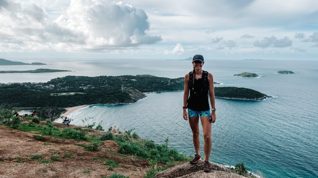
6. Kalim Viewpoint
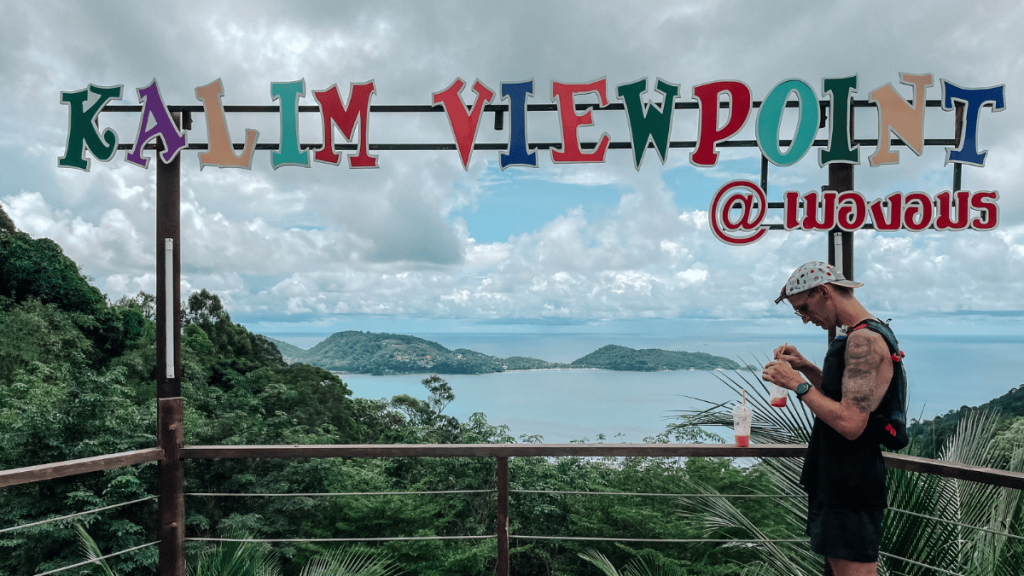
Kalim Viewpoint’s view is…awesome.
I typically started my runs at Manik Dam and worked my way through the hills to Kalim on some mid-longer runs. But this is a great mid-range option starting near Patong Beach.
This trail starts in the southern part of Kamala and rises through the jungles until you pop out at Kalim Viewpoint. You get some beautiful views of the sea along the way. At the top you can see Patong Beach around the hill and Paradise Beach in the distance.
If you’re exhausted by the time you reach the viewpoint, there’s a small house where an older man and his daughter sell drinks and smoothies.
When you’re ready to head back down, just follow the same route down. There’s also the option of doing the Kalim Viewpoint via Hanuman Loop.
Kalim Viewpoint details
- Distance: 4.5 miles (7.5 kilometers)
- Elevation gain: 1200 feet (377m)
- Route type: Out-and-back
- Time: Around 2.5-3 hours
How to get to the Kalim Viewpoint trail
The starting point isn’t particularly obvious. So you may have to do some searching to find it. Use the GPX file to find it easily.
You can find the Kalim Viewpoint trail on AllTrails below:
Personal review of Kalim Viewpoint trail
I loved visiting Kalim Viewpoint. It has one of the best views on the island, in my opinion (especially if you visit at the right time). Plus, the viewpoint was usually the mid-point of many runs, so the Coke or smoothie along with the father/daughter’s smiling faces were a nice pick-me-up.
Highly recommend running this one.
7. Layan Loop
Another regular route of mine: The Layan Loop.
I lived in the nearby community of Baan Don, so getting here only took a few minutes. And the trails were almost always empty except for the rubber farmers and occasional dogs (the nice ones, usually).
You wind around small lakes and cows grazing in fields with a decent mix of uphill and downhill trails. Plus, if you want some flat intervals, this trail has an excellent stretch of flats where you can really open up.
And if you want the beach right after, it’s a short drive away and makes for a rewarding dip at Nai Thon and Bang Tao Beach.
There is some development going on in the area, so these trails are constantly changing. Keep that in mind when running in the area.
Layan Loop details
- Distance: 5 miles (8.5 kilometers)
- Elevation gain: 600 feet (187m)
- Route type: Loop
- Time: Around 2-2.5 hours
How to get to the Layan Loop
To start the Layan Loop, head to the Layan Police Station on the way to Nai Thon. There’s a parking lot right across from it where you can start.
You can find it on AllTrails below:
Personal review of Layan loop
I love the trails in the Layan area. I have friends in Phuket who say that a lot of development is destroying some of them. And it truly makes me sad as I spent so many hours on these trails.
But, that’s why I’m also eager to help others experience some great running on them.
8. Bang Wad Dam
Bang Wad probably has the most trails on the island.
Starting from the dam, there are multiple trails that rise up to the top of, along them, up and down, and all around the surrounding mountains. So this is an excellent area to visit multiple times, for short and long runs. The road that runs around the dam is also popular for road runners.
These trails easily connect with areas that run all the way to Big Buddha and everything in between.
Since there are so many, I’ll list the most popular options in the Bang Wad Dam area:
You’ve got options. But be prepared for elevation. Almost every trail in the area will have a decent amount of elevation gain.
Bang Wad Dam details
- Distance: 2-5 miles (3-8 kilometers)
- Elevation gain: 650-1600 feet (200-500m)
- Route type: Loop
- Time: Depends on the trail
How to get to Bang Wad Dam
Bang Wad Dam is in Kathu. The easiest way is via Soi Chonlaprathan, off of 4020 in Kathu.
Personal review of Bang Wad Dam
I only started a few runs from Bang Wad Dam. Though I ran through it multiple times as I ran from northern Phuket to Big Buddha and Nai Harn Beach on some longer runs.
The trails in the area were always fun to run on, and you wouldn’t see many people. So the run can be enjoyed by yourself or with a group.
9. Kathu Waterfall
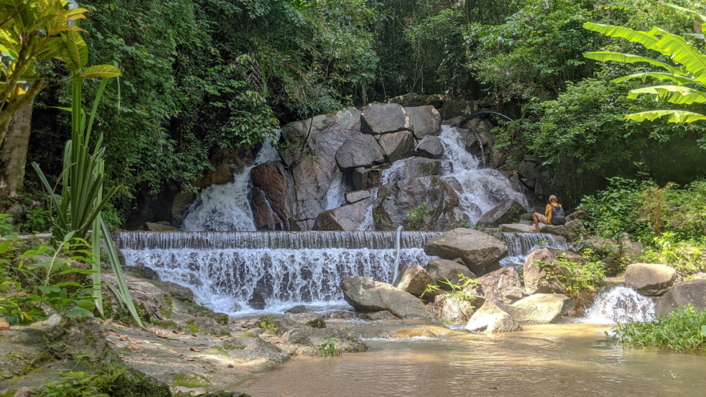
Most options on this list were both longer trails.
But if you want something for an easy day (and with a refreshing dip under a waterfall at the end), then the trail to Kathu Waterfall is for you. It’s also near Phuket Town, which makes it a great stop-off. Phuket Town is one of the best areas to stay in Phuket for runners.
The trail is around a mile long, and it does include some climbing to get to the waterfall. But the end reward is worth it.
You get a little jungle oasis to relax and cool off on a hot Phuket day.
The rainy season will determine the level of the water here. Peak high season in Phuket can get very dry, so the waterfall could be almost nonexistent.
Kathu Waterfall details
- Distance: 1 mile (1.8 kilometers)
- Elevation gain: 600 feet (180m)
- Route type: Loop
- Time: Around 1 hour
How to get to Kathu Waterfall
In Kathu, head toward the Elephant Jungle Sanctuary Phuket and turn on to Soi Nam Tok Kathu. Follow this road to the end, and you’ll arrive at some parking spots and a small Jungle Cafe restaurant.
You can find the exact map and starting point on AllTrails below:
Personal review of Kathu Waterfall
The waterfall itself is beautiful and I highly recommend visiting.
The trail is better off described as a hike since it’s so short, and half of it is uphill. But it’s not a bad option for some hill repeats.
10. Samet Nangshe Viewpoint
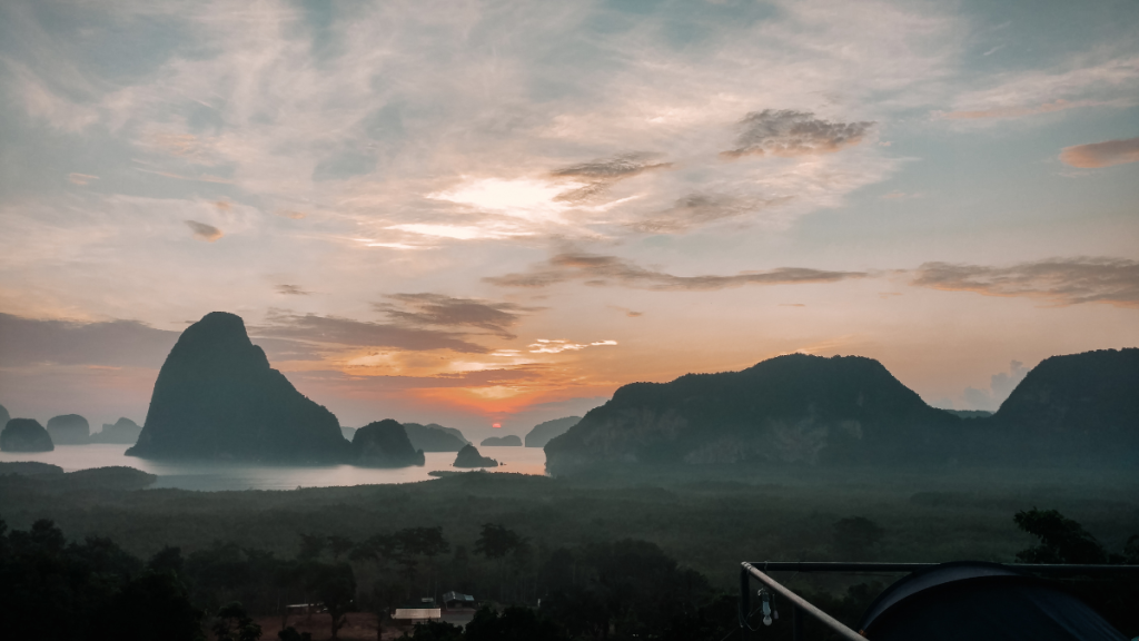
Like Kathu Waterfall, this is more about the scene at the end than the trail itself. Plus, it’s not on the island, it’s a bit north in Phang Nga.
But, it’s that nice that it’s worth mentioning here.
Samet Nangshe is a great way to see some of those classic views you think of when you think of Thailand. The forest-covered limestone rocks erupting out of the bay. The emerald green waters reflecting in the sun.
And when you’re there for sunrise, it doesn’t even seem real.
This would be a great option to run while traveling. For example, if you have hill repeats but still want to explore Thailand, then Samet Nangshe is a great destination for training. Many people visit Phang Nga on a day trip or tours in Phuket to see James Bond Island and some of the other sights in the area.
This is a great option during the dry season, but you may want to avoid it during rainy season.
Samet Nangshe Viewpoint details
- Distance: 1 mile (1.8 kilometers)
- Elevation gain: 440 feet (134m)
- Route type: Out-and-back
- Time: Around 1 hour
How to get to Samet Nangshe Viewpoint
The easiest way to find the trailhead is to type in “Samet Nangshe Viewpoint” into your directions and have it direct you there. It’s becoming more popular, and also easier to reach.
You can find it on AllTrails below:
Personal review of Samet Nangshe Viewpoint
Samet Nangshe’s sunrise was one of the best memories I have while traveling. I say that confidently as someone who’s visited 20+ countries, 10+ US national parks, and countless cities/places for over 7 years.
So, no matter what type of run you have to fit in (or if you pair it with some of Phang Nga’s trails nearby), it’s worth it.
11. Khao Sok National Park

Khao Sok National Park is one of Thailand’s best national parks.
But it is a bit away from Phuket so you must rent a car, bike, or use public transportation to get here.
The park has tons of trails that are great for all experience levels. They wind through the jungle and around Cheow Lan Lake.
This is a great area to see some of the mixed flora and fauna in southwest Thailand. As far as running, you’ll likely be limited to the easy access trails. You must have a guide to go deeper into the jungle. Attempting to navigate these on your own could land you in trouble — whether with the authorities or wildlife.
There’s a ranger station in Khao Sok if you want more information on trails or to hire a guide.
How to get to Khao Sok National Park
Khao Sok is in Surat Thani province, which is about a 2-2.5 hour drive from Phuket. But it’s a great place to get away and enjoy some of Thailand’s nature areas.
You can find all the trails listed on AllTrails below:
Personal review of Khao Sok National Park’s Trails
I love the Khao Sok area and it’s more nature-oriented focus. But, as far as running trails, you may feel limited. There is one long trail that is great for a mid-length run, but you may get bored if you like some variation along the way.
Which Running trails in Phuket will you run?
I love Phuket’s trails.
They’re where I first started trail running regularly. And I fell in love with the variety of the different areas, as well as the different challenges.
I still miss them to this day.
But that’s why I want others to enjoy them! I think Phuket is a HIGHLY underrated trail running destination. And I think the more people enjoy them (respectfully and following leave no trace principles), then trail running can grow in Phuket.
So, bookmark this post for future reference, share it with a friend, and let me know when you’ll be hiking Phuket and what trails you’ll choose!
And join the community of Travel Runners where you’ll get the best routes, tips, and gear sent straight to your inbox below!