Destinations
The Gower Gulch Loop in Death Valley’s Golden Canyon is one of the best running routes in the park.
It’s easy and accessible enough for most people, and it has some epic views along the way that make completing this badlands loop worth the time. So, from what to know, how to get there, and how to do the run — I’ve got you covered with this guide.
Let’s get started.
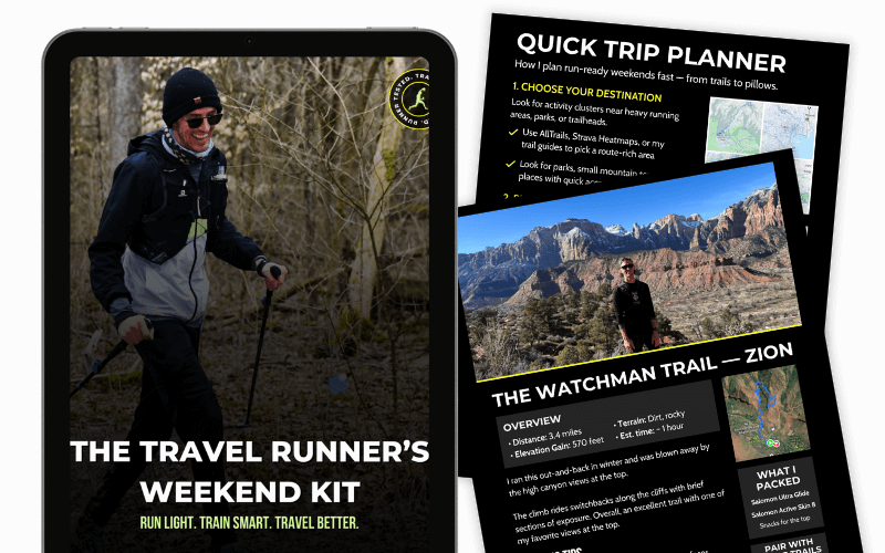
Get the Runner’s Weekend Kit!
- 3 ready-to-run itineraries for national parks and weekend escapes
- My personal runcation packing list — what to bring (and what to skip)
- A quick-start trip planner to choose trails, book stays, and pack fast
Gower Gulch Loop trail information
Here’s what you need to know to tackle this trail:
- Trail type: Loop.
- Difficulty: Moderate. The trail is suitable for all levels of runners. While not overly strenuous, it does have sections that require careful navigation.
- Length: Approximately 4-5 miles, depending on extensions and routes you choose (6-8 kilometers).
- Elevation gain: Roughly 800 feet (244 meters). The trail involves some uphill and downhill sections, but nothing too steep.
- Estimated duration: On average, it takes about 1 to 2.5 hours to complete the loop, depending on your pace and how often you stop to take in the sights.
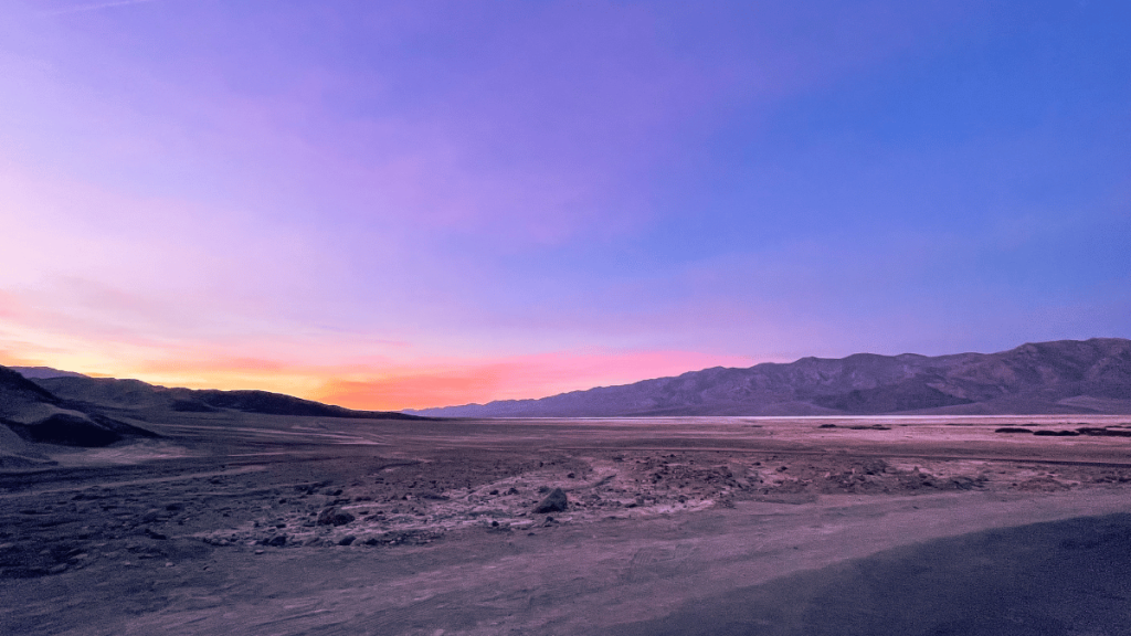
- Best time to run: Early morning or late afternoon. These times help you avoid the intense midday heat, especially during warmer months. Plus, the lighting is amazing during these hours.
- Highlights:
- Manly Beacon: A striking natural feature offering panoramic views of the valley.
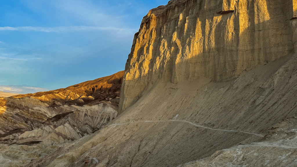
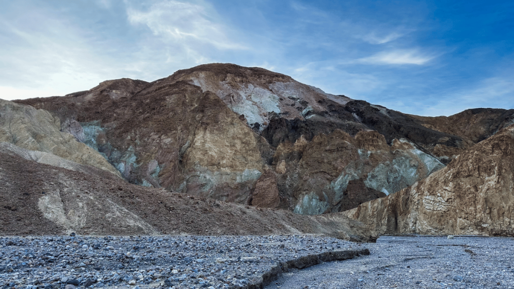
- Badlands: The trail winds through the iconic Death Valley badlands, showcasing unique geological formations.
- Red Cathedral: An impressive wall of red rock that forms a stunning backdrop.
- Zabriskie Point Overlook: While not directly on the trail, a short detour to this famous viewpoint is worth the effort.
If you prefer to have a GPX file or follow it on your phone, you can use my map from Strava above or you can check it out on AllTrails!
How to get to the Gower Gulch Loop Trail
Finding your way to the start of the Gower Gulch Loop and Golden Canyon in Death Valley National Park is straightforward. But planning ahead is important, especially given the area’s remote nature.
Here’s what you need to know:
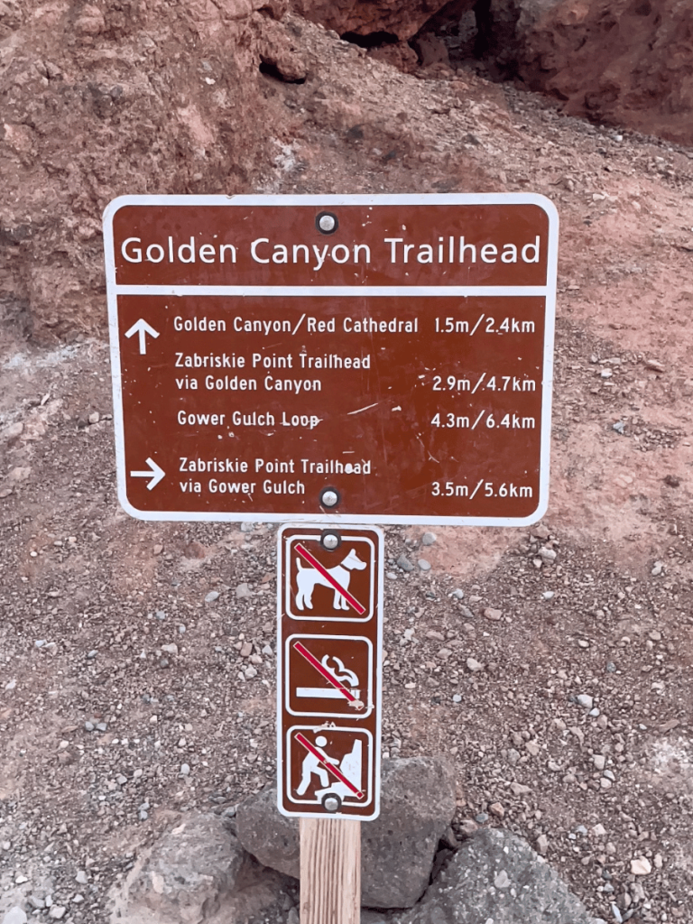
- Location: The trailhead for both Golden Canyon and the Gower Gulch Loop is located along Badwater Road in Death Valley National Park.
- Driving Directions:
- From Furnace Creek, the nearest developed area in Death Valley, head toward Badwater Road and make a right onto it.
- Drive for about three miles. Watch for a sign marking the turnoff to Golden Canyon as you approach. The turnoff is well-marked and hard to miss.
- Turn left into the parking area. This is where you’ll find the Golden Canyon trailhead, which is also the starting point for the Gower Gulch Loop.
- Parking: The Golden Canyon parking lot is large but can fill up quickly, especially during peak tourist seasons. Arriving early in the morning ensures you get a parking spot but also helps you beat the heat for your run.
- No Shuttle Service: Unlike some other national parks, Death Valley does not have a shuttle service to trailheads. You’ll need your own transportation to get to the start of the trail.
- GPS Coordinates: If you’re using a GPS device or a mapping app, input the Golden Canyon parking area coordinates: 36.4208° N, 116.8463° W.
Remember, cell service in Death Valley can be spotty, so it’s a good idea to download maps or directions ahead of time. With these directions, you’re all set to start your adventure on the Gower Gulch Loop and explore the captivating landscape of Golden Canyon.
Best time to run the Gower Gulch Loop in Death Valley
Choosing the right time of year to run the Gower Gulch Loop in Death Valley National Park is crucial for a safe and enjoyable experience.
Here’s what you need to consider:
- Avoid Summer Months: Death Valley is renowned for its extreme heat, especially in the summer. Temperatures can soar well above 100°F (38°C), making running uncomfortable and dangerous.
- Ideal Season: Late fall through early spring (October to April) is the best time to run the Gower Gulch Loop. During these months, the temperatures are more moderate, typically ranging from the mid-60s to 80s°F (about 18-27°C), making for a much more pleasant running experience.
- Springtime Bonus: If you run in late winter to early spring, you might also catch the wildflower bloom, depending on the year’s rainfall. This natural event can add a splash of color to the otherwise stark desert landscape.
- Check the Weather: Before you set out, always check the current weather conditions. Even in the cooler months, the desert can experience sudden temperature changes.
- Crowd Consideration: Keep in mind that the cooler months are also the peak tourist season in Death Valley. If you prefer a more solitary run, plan to start early in the morning to avoid the larger groups.
By choosing the right time of year for your run, you’ll enjoy more comfortable temperatures and see the Gower Gulch Loop at its most beautiful. Remember, no matter when you go, carry plenty of water and dress appropriately for the desert conditions.
How to run the Gower Gulch loop
So, as you can tell, the trail starts at the Golden Canyon trailhead. It’s a loop, so this is where you’ll begin and end the trail!
Here’s a step-by-step guide to following the Golden Canyon trail and ending with the Gower Gulch Loop.
Golden Canyon trailhead
Beginning in the parking lot, you’ll see the sign for the Gower Gulch trail.
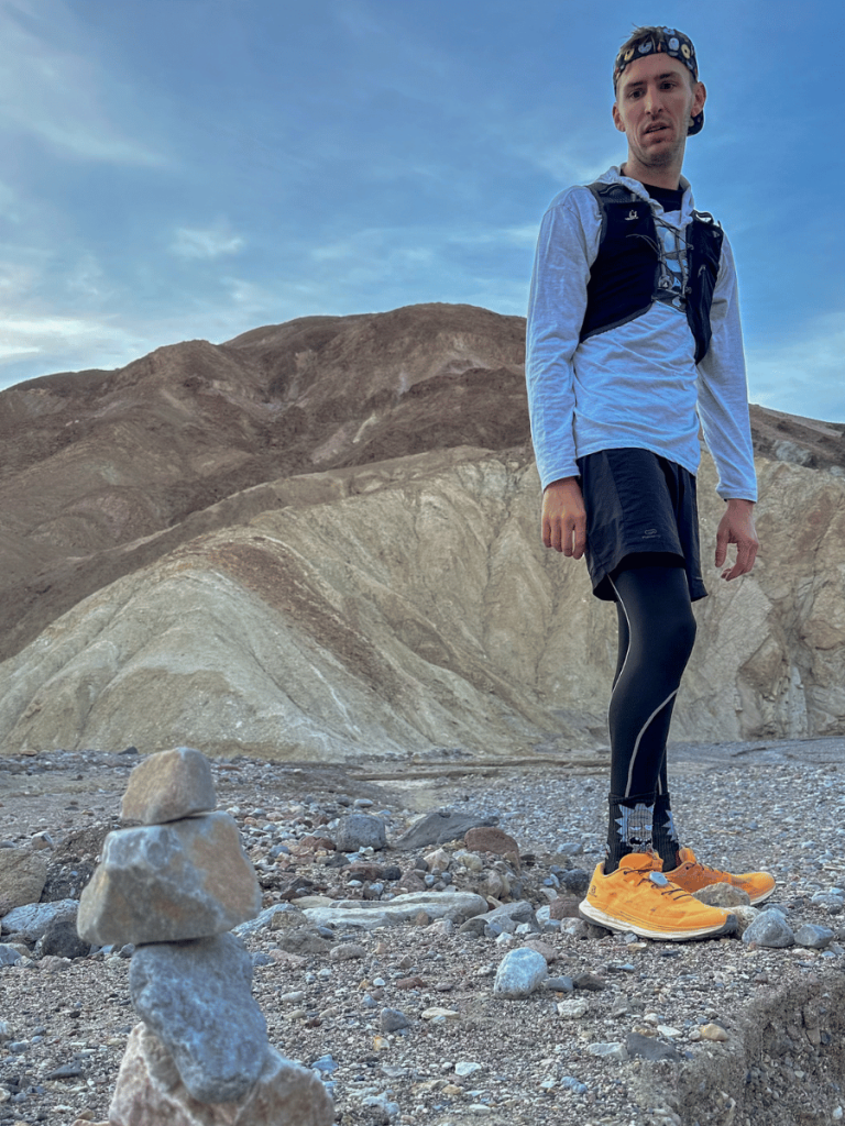
You have the option to run it counter-clockwise or clockwise. We chose clockwise because we had read it doesn’t involve as much climbing and scrambling. And my fiancee and I planned on doing a run, so this sounded great to us!
So go left into the canyon and follow the path where the canyon narrows for about a mile.
Once you reach about a mile to a mile-and-a-half, the trail splits and gives you a choice.
You can continue on the Red Cathedral trail for a quick detour to the Red Cathedral. We skipped out on Red Cathedral due to time constraints with work, so I recommend visiting if you have the time and don’t miss out as we did!
The other option (and where you’ll go even if you visit the Red Cathedral) is to take the trail to the right, which takes you to the Gower Gulch Loop trail.
There’s a sign marking the turn-off, and after, you’ll start a steep ascent to Manly Beacon.
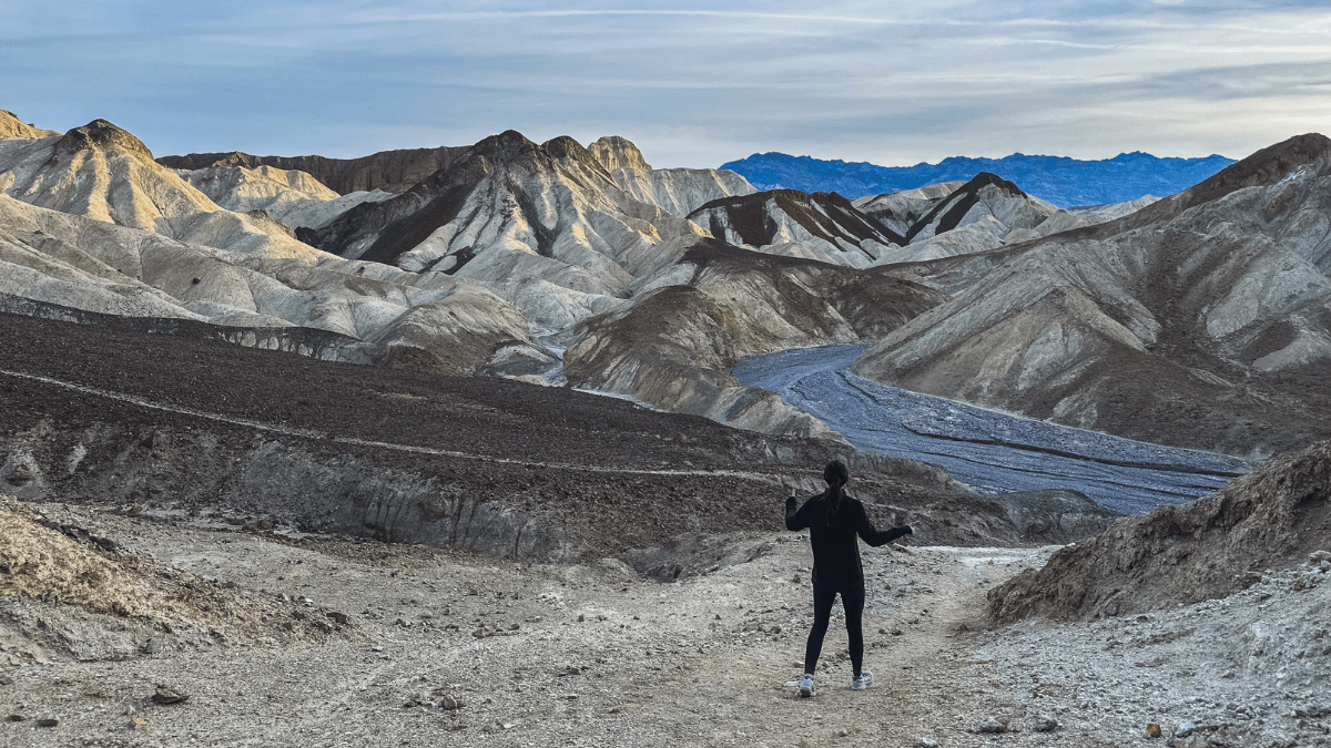
Manly Beacon
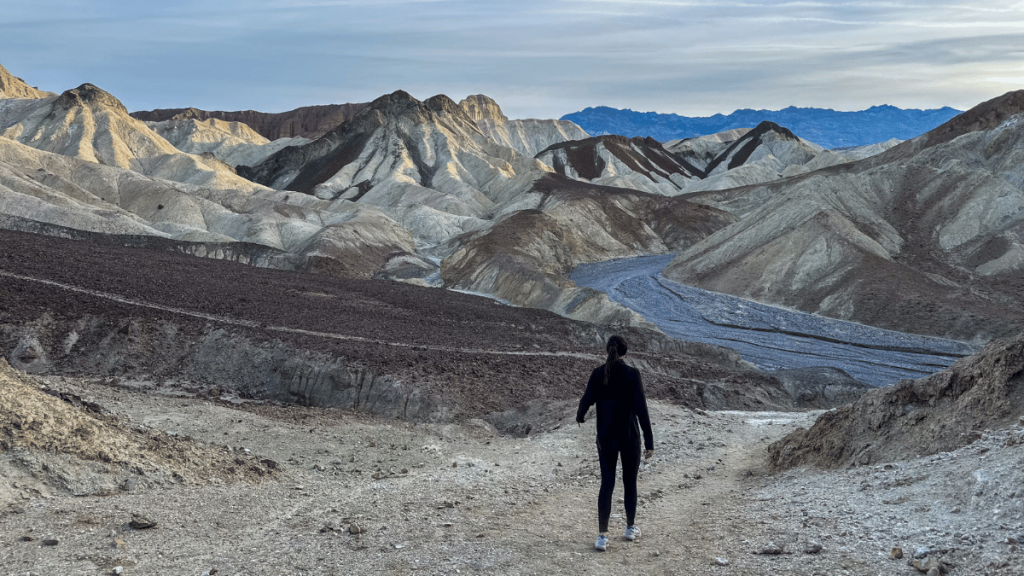
Manly Beacon has some great views out over the surrounding badlands.
Named after William L. Manly, who, along with John Rogers, helped save the members of the ’49er emigrant party that got lost in Death Valley in 1849-50. You can see this point from the Zabriskie Point trailhead for sunrise (one of the top things to do in Death Valley).
There’s also an option .3 mile out-and-back extension where you can go out further on the trail and get even better views of the badlands from the viewpoint.
It’s hard to miss the trail, and I recommend following it for even more epic pictures.
After, you’ll continue the way you came along the trail, where you’ll descend into some smaller yellow hills.
Zabriskie Point trailhead detour
Nearing the 2-mile section of the trail, you have another option — the badlands trail to Zabriskie Point.
We also skipped this running trail because of time constraints (and we had already caught sunrise at Zabriskie Point the previous morning). But if you haven’t had the chance to visit yet, I suggest adding this bit to your run.
Keep in mind it’s a 2-mile loop, so it’s a decent chunk added to your run in Death Valley National Park.
Ultimately, you end up back on the trail you left, and you’ll head back to the Golden Canyon parking area.
So feel free to choose what’s best for you!
Runniung through Gower Gulch
You continue following the trail from here, which leads into the Gower Gulch wash area.
You run through this for about a mile and a half, following the old river path and dropping down some small rocky drops. Eventually, you’ll pop out of the canyon with views out toward the valley and Badwater Road.
Follow the trail for just under a mile back to the parking area, and you’re at your car!
It’s not the most exciting or scenic part of the run, but the relaxing and flat part allows you to run all the way back and simply enjoy your surroundings.
Safety tips for the run
The Gower Gulch Loop trail isn’t considered unsafe by any means. But that doesn’t mean you can’t seriously injure yourself if you’re not careful.
So, here are a few tips to help you have a safe (and enjoyable) time:
- Navigating the trail: The trail includes uneven terrain and narrow paths. Use trail markers for guidance.
- Bring proper footwear: Because of the terrain, it’s best to have a good pair of travel running shoes or trail shoes to keep your feet (and you!) safe.
- Weather considerations: Be prepared for sudden weather changes. Carry adequate water and sun protection.
- Safety first: Stay on the marked trails, especially in the gulch areas, to ensure a safe running experience.
Want more things to do in the area? Check these out ??
Death Valley isn’t the only thing to see in this area. In fact, you can reach tons of the best national parks near Las Vegas, which is only two hours from Death Valley!
So, I hope this guide helps you experience the trail just like I did. And I hope you have just as great of a time!
If you have any questions or thoughts, be sure to leave them in the comments! And, if you want more like this, be sure to sign up for my email list to be the first one to get the latest trails and travels in your inbox!
Kyle Cash | Trail Journal
I’m Kyle — the runner behind The Travel Runner. I run trails all over the world to bring you stories, tips, and gear that actually works. From national parks to forgotten paths, I’ve got mud on my shoes and too many snacks in my pack.
Let’s go find new ground.